Packrafting the Tatshenshini-Parton Loop: A new take on a renowned river trip.
- Tim Kelley
- 1 day ago
- 6 min read

Why Packraft the Tat-Parton Loop:
The Tashenshini-Alsek has long been sought after as a multiday rafting trip. From its headwaters in Northern British Columbia, the "Tat" flows north into the Yukon, doubles back on itself to return to BC before joining the Alsek River and reaching its mouth at the Pacific Ocean. The Tat is a quintessential northern river complete with alpine origins, lush boreal forest, a few scenic canyons, and expansive views of the Coastal Ranges. Typically, a Tat trip starts at Dalton Post and ends with a charter flight out of Dry Bay. Thanks to the C-shaped course of the river, it is possible to hike back to one of the Tat's own tributaries and complete a 100-mile loop. With 80 miles of paddling to 20 miles of hiking, this route offers great bang for your buck and incredibly simple logistics.
The Route:
I first visited this remote corner of BC and the Yukon in 2018 during a packraft trip down the neighboring Alsek River. After the trip, I spent some time looking for other ways to connect the dots elsewhere in the watershed and I became very curious about a route on the Tatshenshini. From its headwaters, the Tatshenshini flows nearly due north before making an 180-degree turn south just beyond the standard multi-day put-in at Dalton Post. From a packrafter's perspective, the "C-shaped" course of a river presents a great opportunity for a loop. In this case, one of the Tat's tributaries, the Parton, further assisted in closing the loop. Given the aesthetic nature of this loop and the incredible 80-mile to 20-mile paddle-to-hike ratio, I figured this route must get done with frequency. After reaching out to a few Yukon contacts, I didn't dig up much more information and figured the only way to know was to go!
The Tatshenshini: The first river segment of this loop has three distinct sections
1) The Upper Tatshenshini (Day stretch)
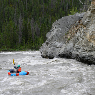
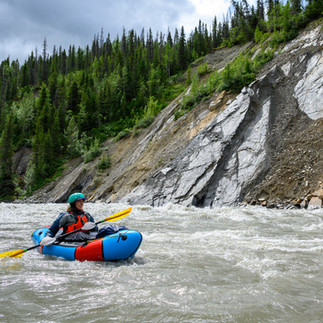
While not typically paddled as part of the Tatshenshini multiday trip, launching on the day-stretch from "Bear Camp" helped us close the loop and added some fun whitewater. The first few miles of the river meanders through some scenic bends before it reaches a confluence with the Blanchard River where the whitewater starts in earnest. This section gets a III-IV rating and many of the rapids have specific names given by the local rafting outfits. At high flows, the Upper was pushy and continuous but still had eddies in all the right places. Swims could be long, and it is worth noting that this section of Tat is a half step more difficult than the "Canyon Section" below the traditional multiday put-in. We found a few gravel bar camping options near the confluence with the Takhanne and more should be available at lower water levels.
2) The Tatshenshini Canyon
This classic multiday section begins at Dalton Post. A few miles downstream, the flow constricts as the river enters a scenic low-walled canyon with consistent III-III+ whitewater. All of the rapids are reasonable to boat-scout, and the biggest features of this section come in the form of "wall-shots" where reactionary waves and seams created by the canyon wall make for some swirly water.
3) The Tatshenshini below the canyon
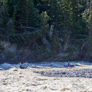
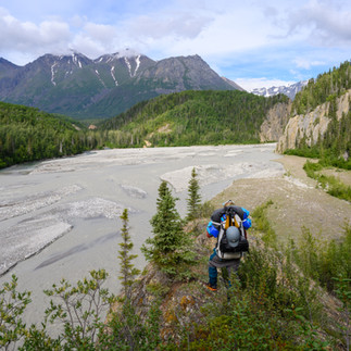
After departing the canyon, the whitewater ratches down but the scenery keeps getting better. While the river maintains a consistent and swift pace, there are just a few notable rapids. The slowdown offers ample opportunity to appreciate the expansive views and to be on the lookout for wildlife. There are many established campsites frequented by rafters along this section, and (this) resource compiled by the park shows their location and relative likelihood of bear encounters. As a small party of three, living in a cooler-less and table-free fashion, we were happy to leave these camps to the rafting groups as there are plenty of gravel bar camping options.
The Hike: Leaving the Tat, the hike accessing the Parton segments nicely into 3 sections
1) Along the O'Connor
From its confluence with the Tat to the departure point, the walk up the O'Connor was one of the highlights of the route. Most of the travel is efficient gravel bar walking aided by the packraft crossings wherever the river runs into a cliff wall. We elected to keep our drysuits on and boats accessible so we could ferry back and forth as needed. Before the advent of internal storage, rigging your boat with your backpack on the bow with the shoulder straps facing up (portage mode), was a seamless way to transition between paddling and hiking and served us well during this portion of the route. Eventually, the river constricts through a short canyon and you'll have to ascend above river level into the forest before you can return to gravel bars. We found decent game trails on the south side.
2) O'Connor to the Alpine
From the confluence of the O'Connor and the south-flowing tributary, an excellent game trail helped facilitate the steep climb out of the valley. The trail fizzled out and the bushwhacking ensued. Where possible, we stuck to the tree cover as it provided better walking with less underbrush. We figured we would eventually encounter signs of the old airstrip depicted on topo maps, but any obvious signs have been reclaimed by dense underbrush. Sticking close to where we could see a faint break in the vegetation on satellite imagery, we did our best to follow the historic road. The "road" was initially easier to lose than it was to find, but it became more defined as it ascended out of the valley toward the alpine.
3) Alpine to the Parton
The walking improved once we made it back to the shrubline. While the old road grade continued to serve as a useful "handrail" to guide our travel, actually walking on it was difficult since it has been reclaimed by willows and alder. The road widened once the grade crossed the creek back to the south side. Here the 'schwacking disappeared and travel was excellent all the way to the Parton. Eventually, we had to leave the road to make the final descent to the Parton but we were able to find a nice gravel ridgeline to follow down to the river.
The Parton:
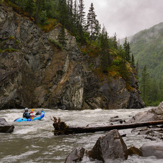
Depending on water levels, the Parton might offer the most continuous whitewater on the route. Based on a write-up from a fall trip day trip on the Parton, we figured we would be lucky if we encountered any class III. Instead, the river was a non-stop roller coaster after leaving the first few miles of braided channels. While most of the rapids were class III in character, the limited eddies, tight corners and potential wood hazard made the last few miles feel more serious during our high summer flows. Once the canyon opens back up, keep your map handy to find the small river-right channel that deposits you at an ATV trail. This trail is the final portage back to the Upper Tat where you can ferry across to your vehicle.
Logistics:
While the classic Tatshenshini-Alsek trip ending in Dry Bay typically requires 3 permits and a clearance from U.S. customs, this loop route is about as logistically simple as it gets. Overnight trips in Tashenshini-Alsek Provincial Park not bound for Dry Bay do NOT require a permit (as of 2024). Better yet, there are no charter flights or shuttles required (unless you count your hike...)! The start and finish of this route, near "Bear Camp", BC is less than an hour and a half south of Haines Junction, Yukon.
Alsek-Lost Coast Alternative Finish:
While the Tatenshinini Loop is a fun and beautiful route with big logistical upsides, it does miss the stunning, river-side glacial scenery of the Lower Alsek. For packrafters interested in paddling the full length of the Tat-Alsek, consider finishing the trip with a hike along the Lost Coast to the town of Yakutat. The 35-mile section of scenic beach is a worthy hike or fat bike in its own right. With consideration of the tides, some of this exit route can be paddled thanks to a few coastal rivers flowing in a favorable direction. Yakutat offers daily commercial flight options to Anchorage which eliminates the much more costly charter flight out of Dry Bay. For more information on this option check out the map below or my description from a 2018 Alsek trip that used the Lost Coast as egress.













Comments